
Update posted Feb. 2
 After partial lifting of evacuation order residents north of Rat Creek return; those south still subject to Highway 1 closure
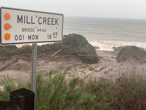
–This week, Monterey County partially lifted an evacuation order that had been in place since Jan. 26, in advance of approaching rainstorms for areas downslope of the Dolan Fire burn scar which were subject to debris flows. At the request of the California Highway Patrol, and in support of this order, Caltrans had initiated a 44-mile closure of Highway 1 on the Big Sur coast to create safe conditions for evacuations to take place. During the intense rainstorms, and in an area below the Dolan Fire burn scar, a section of road washed out at Rat Creek, severing Highway 1 and creating a 150-foot chasm in the roadway at Post Mile 30.2.
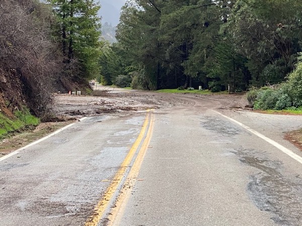
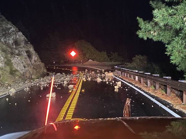
Although the washout at Rat Creek was the most apparent and significant devastation, it was not the only location on Highway 1 along the Big Sur coast to suffer damage. Caltrans and contractor crews working north and south of Rat Creek on Highway 1 continue to clear multiple debris piles, remove slides, remove accumulations of water, clear and repair drainage systems, and stabilize damaged sections of roadway at approximately 60 locations that were impacted by storm damage.
Several of these locations still need to stabilize and dry out before final cleanup and repair work can restore the highway to allow for public use. At Rat Creek engineering alternatives are being analyzed and data is being gathered with no timeline available for complete reopening at this time.
Early tthis week, the northern limit of the Highway 1 closure will be relocated to the vicinity of South Coast Center near Post Mile 34.
A traffic control checkpoint at that location will be staffed 24 hours a day allowing only locals to pass and return to assess any damage at their homes. There will be sections of the road between the South Coast Center closure and Rat Creek that will be restricted down to one lane and local motorists are advised to drive with appropriate caution. During daytime hours contractor forces will be working in this area and may cause short delays.
As crews effect repairs and stabilize the roadway over the next several weeks, the northern traffic control checkpoint should continue to move southward until it reaches the approach to Rat Creek.
Damage to Highway 1 south of Rat Creek remains in such condition that it will delay the ability of residents who live south of Rat Creek to return to their homes.
The southern closure, currently at Ragged Point, will be moved north to Willow Creek Rd. at Post Mile 11.2 as of Monday at 6 p.m.
In a similar fashion as in the north, the southern edge of the closure will continue to move tracking the progress of maintenance and contractor crews as they work north.
While there is no current timeline for the complete reopening of the southern end of the closure, continuous updates will be provided in the days and weeks ahead.
Original story posted Jan. 28
Highway 1 closure on Big Sur Coast extended
 –A full closure of Highway 1 on the Big Sur Coast will now remain in effect through Friday Jan. 29. The extension of this closure is in support of ongoing evacuations that are expected to continue into Thursday and Friday this week and to assess damage from this week’s rainstorm.
This closure extends from Ragged Point in San Luis Obispo County to just south of Deetjen’s Big Sur Inn in Monterey County (44.6 miles). The closure began on Tuesday Jan. 26, at 5 p.m.
Monterey County has issued an Evacuation Order for areas downslope of the Dolan Fire burn scar where this storm brings an increased likelihood of debris flows. Caltrans is working with local agencies to minimize travel into Big Sur to allow residents and businesses to evacuate in the safest conditions possible.
There are several areas of moderate damage, rockfall, and mudflows on Highway 1 inside the closure. Significant rain is expected this evening and the overnight hours. Assessments are expected to take place Friday morning, Jan. 29, prior to any decision about a possible reopening of the highway or modifications to the highway closure.
More information will be known following these assessments and an update will be provided Friday afternoon.
Ragged Point is located 1.45 miles south of the SLO/Monterey County line:
Deetjen’s Big Sur Inn is located in Monterey County at Post Mile 42.1:
Barricades, cones, as well as message and directional signs will be in place at both ends of the closure to alert motorists traveling in the area.
Caltrans reminds motorists to move over and slow down when driving through highway work zones.
For traffic updates on other state highways in Monterey and San Luis Obispo Counties, travelers may contact Caltrans District 5 Public Affairs at (805) 549-3318 or can visit the District 5 website at: https://dot.ca.gov/caltrans-near-me/district-5