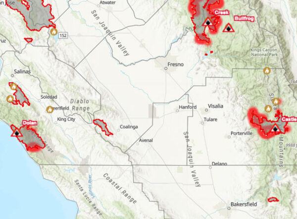
–The Dolan Fire, burning for 28 days now from Big Sur to Fort Hunter Liggett, has torched 122,178 acres as of Thursday morning. The blaze is 40-percent contained, according to the US Forest Service.
On Tuesday, firefighters began a burnout operation to tie in the southern portion of the fire from Highway 1 to the black containment line on southeast portion of the fire area. Crews began the process of joining the burnout operation from Prewitt Ridge down to the highway through the Pacific Valley subdivision, along Prewitt Ridge to McKern Road, Cal Fire reports.
On Wednesday, crews and heavy equipment spent several days preparing roads to be used as containment lines on a planned burnout that is intended to prevent the fire from moving south of McKern and Nacimiento-Ferguson Roads. Ignitions that began along Prewitt Ridge yesterday will progress slowly east today with firefighters along McKern Road using water to cool the perimeter. Fixed-wing aircraft continued retardant drops to moderate fire behavior. This burnout operation is expected to take a few days to complete depending on wind and weather conditions, Cal Fire reports.
EVACUATIONS: The Monterey County Sheriff’s Office has evacuations orders and warnings in effect. For current evacuation information call 211.
ROAD CLOSURES: HWY 1 is closed between milepost 25 and milepost 10. Nacimiento-Ferguson Rd is closed to all traffic from Highway 1 to the Fort Hunter Liggett base boundary line. For more information visit https://roads.dot.ca.gov/.
REGIONAL FOREST CLOSURES: All National Forest Lands are closed to public entry in California.
WEATHER: The marine layer has been difficult to forecast but generally, there has been decreasing coverage, especially inland where temperatures are getting hotter with lower relative humidities throughout the day. Continued winds out of the southwest.
- Click here for Cal Fire’s incident update on the Creek Fire burning near Shaver Lake, which has burned 228,025 acres and is 18-percent contained
- Click here for US Forest Service’s incident update on the Castle Fire burning near the Sequoia National Forest, which has burned 122,835 acres and is 12-percent contained

Air quality in Paso Robles and San Luis Obispo County is moderate, according to SloCleanAir.org, and is forecast to remain moderate for the next few days.
